
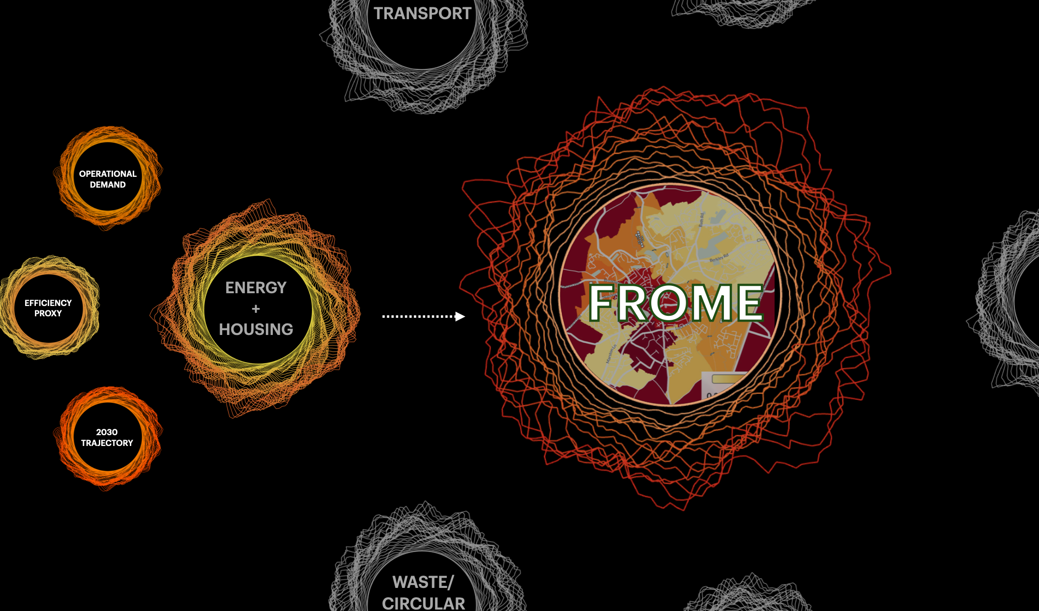
Frome Climate HALO showing Energy and Housing data combining operational demand, housing efficiency and the town’s 2030 energy trajectory.
Over the past year, ORA has been working with Frome Town Council to design and deploy the Frome Climate HALO—a municipal climate observatory capable of turning fragmented local data into a living signal of condition, direction and momentum. This post is a brief on that project.
[For the full research paper that outlines our process and findings with the Frome deployment, click this link to academia.edu.]
PROJECT BRIEF
Most communities already have climate plans, targets, and programmes. The data exists — scattered across council workstreams, public datasets, and partner projects — but rarely in a form that empowers leaders or residents see whether they are actually moving toward their goals, and at what pace.
Climate HALO closes that gap.
A Climate HALO is a whole-system model of a community. It identifies the major systems that drive resilience and decarbonisation, breaks them into nested parts, and connects each to data, targets, and interventions — producing a holistic, living signal of where a community stands, where it is heading, and how fast. Essentially, offering a view of complex systems that can be read at-a-glance.
WHAT IS HALO?
The ORA HALO is a patented generative visualisation framework that maps real-world variables onto a dynamic visual object. As conditions change, the HALO changes with them — a continuously updating signal of system state, trajectory, and even the quality of the data that is generating the signal. HALO has been deployed across enterprise, health, and environmental systems, including Adobe's Global Operations Center, a heart-health application developed with the Mayo Clinic, and a prototype model of the Planetary Boundaries.
Frome is its first application for a municipal dashboard and we couldn’t be more excited about the potential.
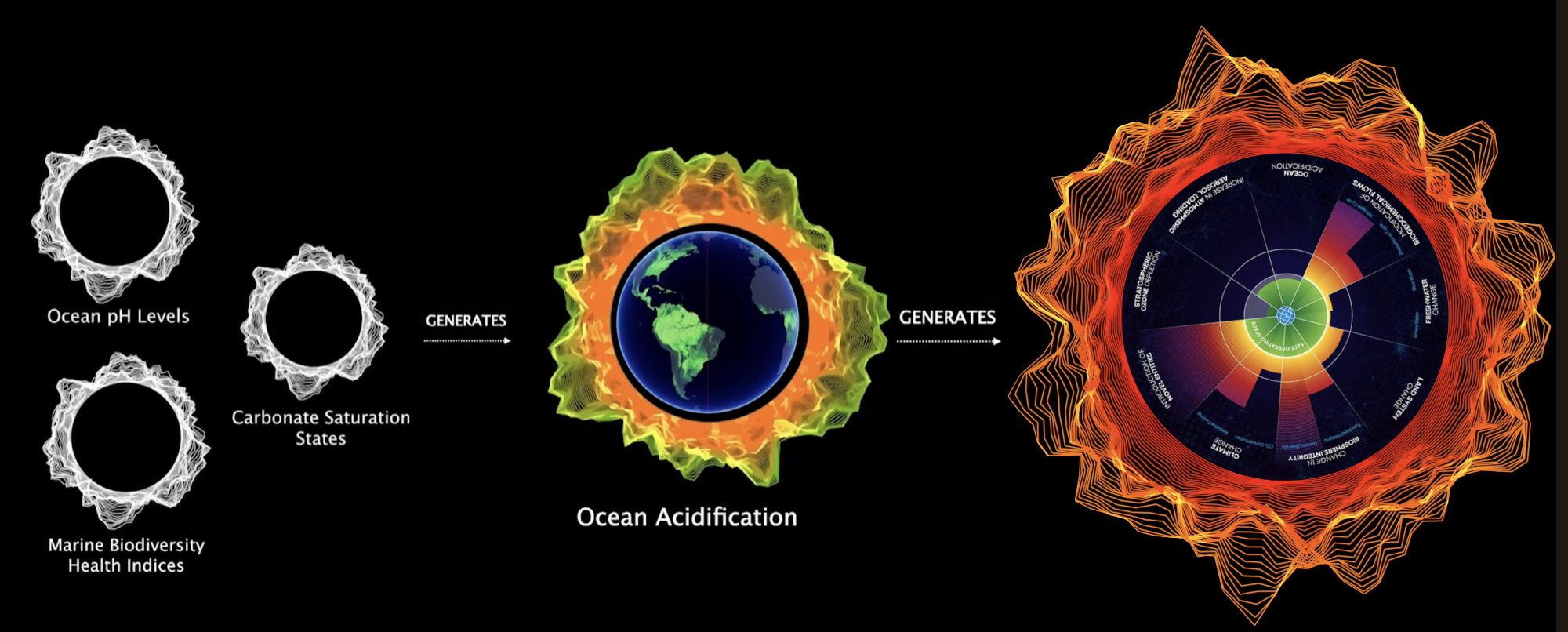
Climate HALO’s nested system live signaling the Planetary Boundaries
FIRST DEPLOYMENT: FROME TOWN COUNCIL (FTC)
In 2025, ORA delivered the first UK Climate HALO with Frome Town Council — one of the country's most progressive civic governments, which has a stated goal of carbon neutrality by 2030. Working with the council's climate team, we designed and built a nested climate and resilience architecture for the town, organised around six domains: Home Energy, Transport, Waste & Circular Economy, Nature & Flooding, Food & Community Resilience, and Community Engagement.
It is designed to address two connected questions:
Decarbonisation: Is Frome reducing emissions and energy demand fast enough to meet its 2030 climate commitments?
Resilience: Is Frome becoming more able to withstand climate, ecological, social, infrastructure, and resource pressures?
The result is what we believe to be the UK's first town-scale climate and resilience architecture — and Frome is now using it to guide survey design, citizen engagement, intervention tracking, and fundraising for its next phase. Read the exhaustive (!) report, here.
THE VISION
Our long-term aim is a national climate intelligence platform, built one town at a time, that evolves into a scalar architecture that can be navigated from household, to neighbourhood, to town, to county, to nation.
We are looking for a small number of communities ready to become early Climate HALO partners: places with ambitious leadership, active residents, and a genuine interest in understanding their own progress toward resilience and decarbonisation.
Partners work directly with the ORA team to:
map the systems that drive local resilience and climate outcomes
design a nested HALO architecture for their community
connect existing data to live or semi-live signals
identify the gaps that matter most for future measurement
create a shared framework residents, funders, partners, and government can all read
Communities need better instruments for navigating the transition ahead. Climate HALO is one attempt to build one.
